
Ancient Fluvial and Shallow Marine Sedimentary Systems Field Course, Sydney Basin, NSWThe Ancient Fluvial and Shallow Marine Sedimentary Systems Field Course runs over approximately five days in the Sydney Basin, NSW. The course runs from Sydney to Canberra, with students staying in Sydney, Wollongong and Batemans Bay. | |
Background to the Sydney BasinThe course is run at coastal exposures through the Permian and Triassic stratigraphy. These locations provide exceptional outcrops with superb sedimentary structures, varied trace fossil assemblages and well exposed stratigraphic relationships in scenic and easily accessible locations. The course itinerary broadly follows the depositional history of the basin in reverse, beginning in the Middle Triassic and working down through the Permian. While this flyer shows the major outcrops, we will make informal stops at other outcrops of interest and point out relevant features during transit. |
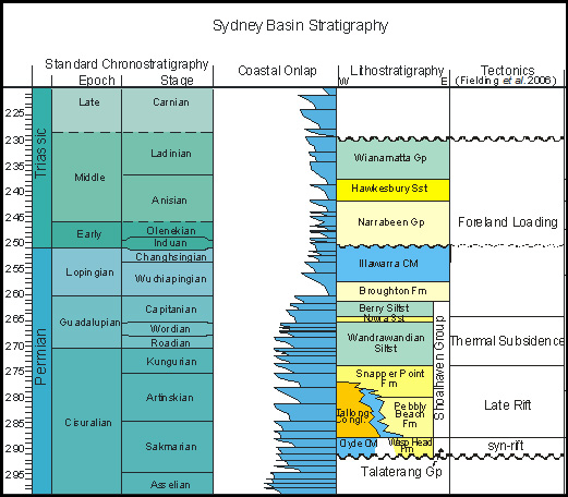
Stratigraphy of the Sydney Basin |
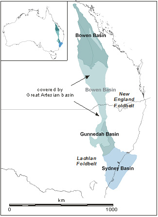
Geographic Distribution of the Bowen and Sydney Basins |
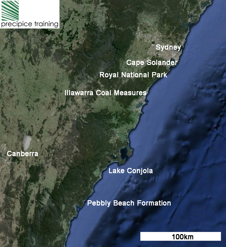
Major Outcrops in the Sydney Basin Field Course |
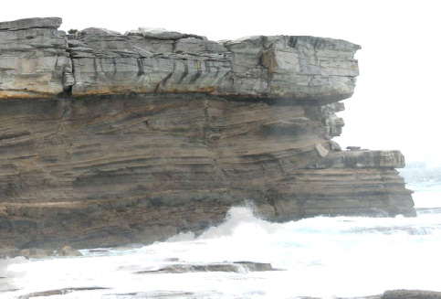
Hawkesbury Sandstone, Cape Solander and Royal National Park, Sydney:This field day examines a number of superbly exposed outcrops of the high net to gross Hawkesbury sandstone. This unit is interpreted to be deposited by large, laterally mobile sandy river systems. The outcrops visited highlight different aspects of this unit including large sandy cross bedded fluvial channels, muddy overbank/channel fill successions and splay channels. The geometry of the key stratigraphic features, particularly the abandoned channel fill at “The Cobblers” in the Royal National Park are particularly well displayed. | |
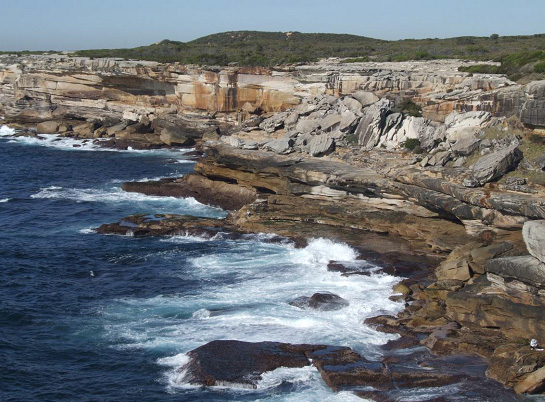
Hawkesbury Sandstone, Cape Solander |
Mud Filled Abandoned Channel, Hawkesbury Sandstone, Royal National park |
Illawarra Coal Measures, Austinmer and Woombarra Beach, Wollongong:The Illawarra Coal Measures are a Late Permian (Tatarian) unit of the south-eastern Sydney Basin that comprises coal, sandstones and mudrocks. Lateral equivalents occur in other parts of the basin (Newcastle and Tomago Coal Measures). The units are extensively commercially exploited for coking and steaming coal. We visit outcrops of Wilton Formation, which sits within the Coal Measures, at Austinmer and Wombarra Beach. The outcrops represent a variety of depositional environments ranging from distal marine, shallow marine, embayment and peat mire. |
|
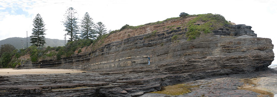
Illawarra Coal Measures, Austinmer Beach |
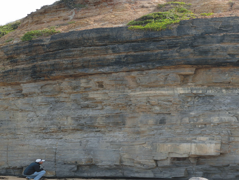
Stratigraphic Section of the Illawarra Coal Measures, Wombarra Beach |
Lake Conjola Modern Estuary, Ulladulla Area:Lake Conjola is one of a series of wave-dominated barrier estuaries occurring on the NSW coast south of Sydney. It lies 200km south of Sydney and some 15km north of the regional town of Mollymnook/Ulladulla. It is a narrow valley, incised into the Permian Nowra Sandstone during times of Quaternary sea level low stands, and subsequently flooded during rising sea levels. Lake Conjola provides the opportunity for students to observe modern central mud basin, flood-tidal delta and beach/barrier facies as an analog to the Permian/Triassic outcrops observed during this course. |
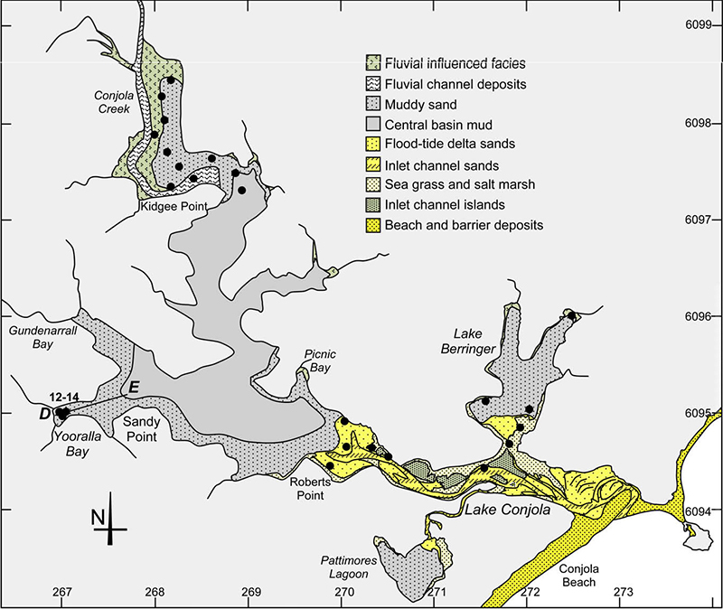
Facies Distribution, Lake Conjola (Sloss et al. 2009) |
Pebbly Beach Formation, Mill Point, Batemans Bay Area:The Pebbly Beach Formation is investigated during the course at locations at Mill Point and Cape Upstart. This unit is interpreted to have been deposited in shallow marine and coastal settings, with many cycles of relative sea level changes obvious. In the lower, accessible parts of the Mill Point cliffs the outcrop is dominated by muddy and heterolithic estuarine facies. The architecture of these deposits is comprised of a number of laterally and vertically stacked channels. Surrounding strata are open marine, including various shoreface and offshore facies, and include sandy as well as muddy and heterolithic lithologies. Pockets of hummocky cross stratified and laminated shoreface sandstones are preserved as erosional remnants between estuarine channel deposits. Bioturbation occurs throughout, but exhibits notably more diversity in the fully marine intervals. | |
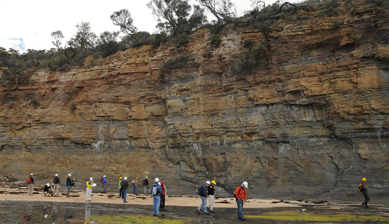
Pebbly Beach Formation, Mill Point, Batemans Bay Area |
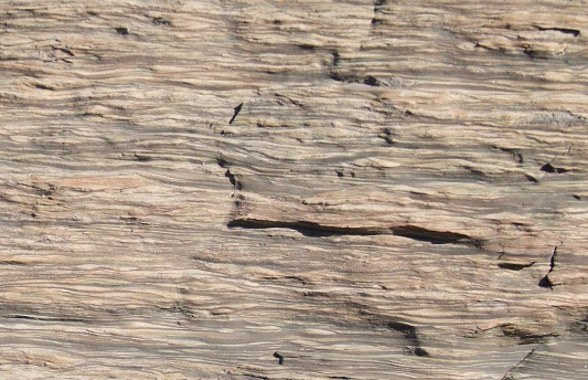
Lenticular lamination on inclined heterolithic surfaces within the Pebbly Beach Formation, Mill Point, Batemans Bay Area |
Pebbly Beach Formation, Durras Beach/Cape Upright, Batemans Bay AreaThe cliff face at Cape Upright exhibits a succession of laterally continuous sands and interbedded heterolithic and muddy units. The most prominent feature of the exposure is incised channels filled with inclined heterolithic facies and massive dark mudrock plugs. The channels incise into sandy shoreface facies and are in turn overlain by shoreface deposits. Sedimentary structures of the channel fill succession include ripple cross laminations with bifurcating mud drapes and current reversal structures, indicating tidal current activity. | |
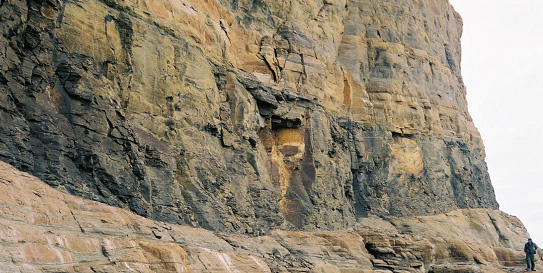
Estuarine Channel Fill, Point Upright, Batemans Bay Area |
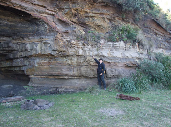
Shoreface Succession, Durras Beach, Batemans Bay Area |